NewsData stories
Data stories2 October 2023

Background data of City2Seas Mtwara

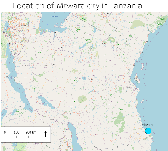
Mtwara Buildings data consists of digitalized buildings in the city of Mtwara in south-east Tanzania. The city is located on the coast of the Indian Ocean near the border of Mosambik. The study area consists of only part of the Mtwara city, eight wards out of eighteen. This data was collected in part of a […]

Resilience Academy

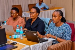
Photo: Resilience Academy

Mtwara Buildings data consists of digitalized buildings in the city of Mtwara in south-east Tanzania. The city is located on the coast of the Indian Ocean near the border of Mosambik. The study area consists of only part of the Mtwara city, eight wards out of eighteen.
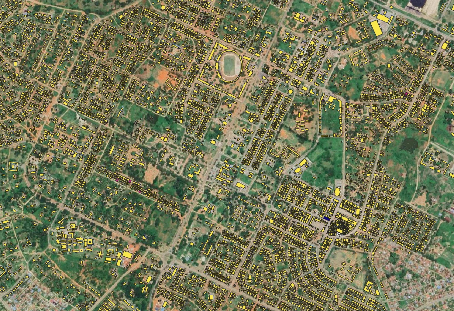
This data was collected in part of a bigger study about the litter in Mtwara city. The collection of the data was done in August and September 2022 by two companies, one from Italy and one from Tanzania, and alumni students. The collection was done on behalf of the Mtwara local government. 

The alumni students had a big part in this since they digitalized the building from drone images. The Open Map Data Tanzania provided the drone images for this project. After the data collection, the alumni students made a visit to the sites they were digitalizing. During this field visit they checked the correctness of the data’s attributes. 

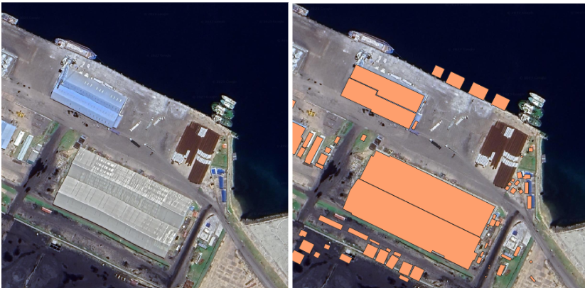
The digitization has mostly been successful and the Digitized shapes correspond to the building shown in the satellite image. However, there are a few problems, for example in the industrial area of the port, the building has not been digitized in one part,there is a gap between the polygons. It looks like there were two buildings instead of one. In the port, compared to the satellite image, buildings have been digitized on the water and bare land.
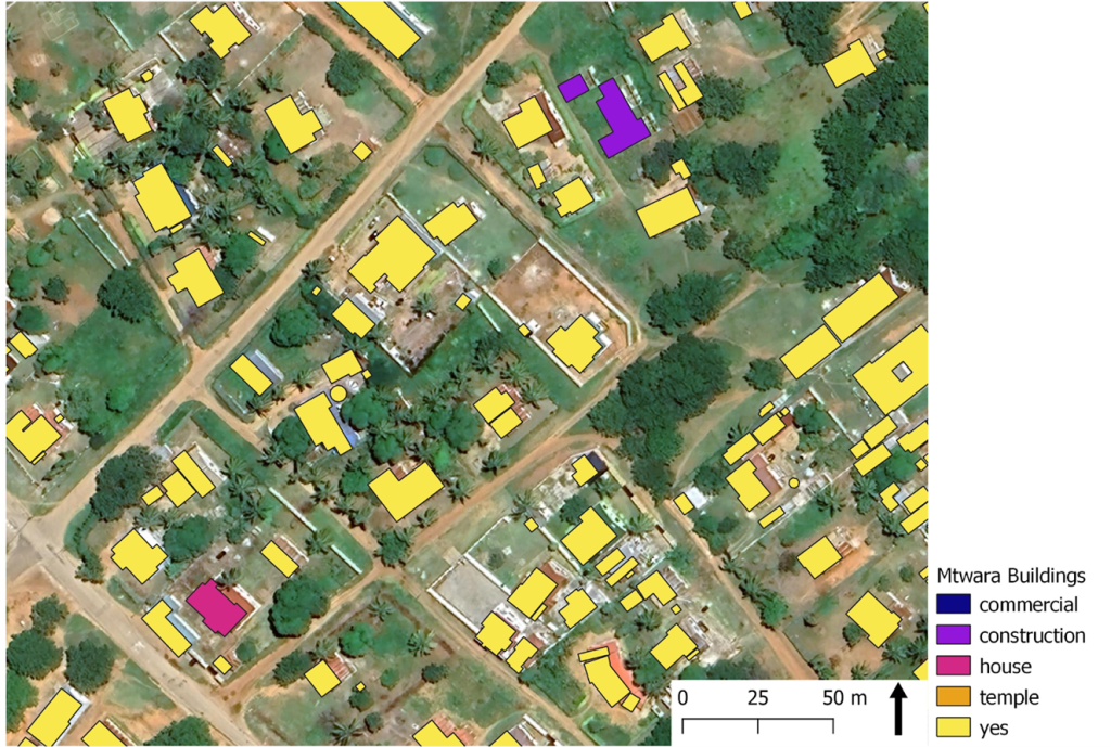
In the data, the buildings are divided into five different categories. A minority of the digitized buildings have an attribute describing their use. The attributes that describe the use of the buildings seem to be fine as far as they are defined accurately. For example, a building described as a construction site also appears that way on a satellite image.
Share

Related articles

News30 Jun 2026

Building climate agency through geospatial and challenge-based learning – reflections of the Shape2Gether project

Authors: Niina Käyhkö, Sanna Mäki, Jukka Käyhkö   The Erasmus+ higher education cooperation project “Shape2Gether” (Shaping Innovations in Education for Sustainable Development: Contextualizing Geosciences, New Technologies, and Serious Games with Climate Change, 2024–2026) brought together seven university partners and one company from across Europe to transform education for sustainable development. The project aimed to integrate […]

Read more →
News, Training1 Apr 2026

Resilience Academy delivers four-day training on geospatial data collection, quality management, and sharing in the Climate Risk Database across two Tanzanian cities.

By Msilikale Msilanga, Amedeus Kimaro and Massoud Hamad In March 2026, the Resilience Academy conducted two rounds of a four-day training on Geospatial Data Collection, Data Quality Management and Sharing in the Climate Risk Database. The first round took place in Tanga from 9 to 12 March, and the second round followed in Mwanza from […]

Read more →
News9 Mar 2026

Shaping Together in Finland – Sharing the Shape2Gether Experiences in Turku

The Shape2Gether -project is about shaping innovations in education for sustainable development: contextualizing geosciences, new technologies, and serious games with climate change. If you wish to explore insights from the three summer schools that were organized during this project, you can find the Norway blog post here, the Malta blog post here, and the Germany […]

Read more →
News10 Jan 2026

85 students and alumni engaged in the 2025 Data Visualization Challenge to develop geovisualization solutions supporting urban water and climate resilience decision-making in Tanga and Mwanza.

By Msilikale Msilanga Young people develop the most robust skills when they engage in hands-on work on real-world problems. Resilience Academy organized another visualization challenge for 2025 as part of ProWA-SASA project, collaborating with partners like GIZ and ProWAS SASA Partners from Mwanza and Tanga cities. This initiative provided university students and recent graduates with […]

Read more →