NewsData stories
Data stories2 October 2023

Litter data from Mtwara, Tanzania to prevent ocean pollution

In the City2Sea project Coastal City Strategies for Prevention of Generation and Transport of Plastic Litter to Oceans funded by the World Bank, extensive mapping of litter was executed in coastal city of Mtwara, Tanzania. The data collection was organized by Open Map Development Tanzania in cooperation with the Resilience Academy. The project included data […]

Resilience Academy

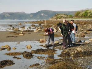
Photo: Resilience Academy

In the City2Sea project Coastal City Strategies for Prevention of Generation and Transport of Plastic Litter to Oceans funded by the World Bank, extensive mapping of litter was executed in coastal city of Mtwara, Tanzania. The data collection was organized by Open Map Development Tanzania in cooperation with the Resilience Academy. The project included data collection to other datasets as well. The litter data was collected by a mobile phone app (Litterati App). 

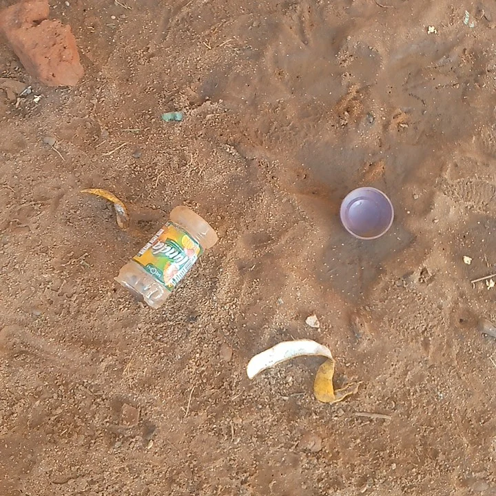
10 university students were utilized to take photos of every piece of litter within preassigned 287 road segments (50 m) and shorelines to Litterati app. Then Litterati information was analyzed using the in-built artificial intelligence and manual checks to define the top categories, materials, objects and brands of litter.

This dataset is useful in the planning of waste management systems. Only 10-20 % of residents of urban Tanzania receive solid waste management services. Indian Ocean is also very polluted, which is a significant risk to the marine ecosystems. According to the project, most of the litter found in Mtwara was plastic, which poses long-lasting threats to the marine ecosystems. Marine ecosystems are also economically important for Tanzanians who work in tourism and fishery. Fishery provides over 200 000 direct and over 4 500 000 indirect jobs in Tanzania (The annual fisheries… 2020). Their livelihoods are at risk because of the pollution.
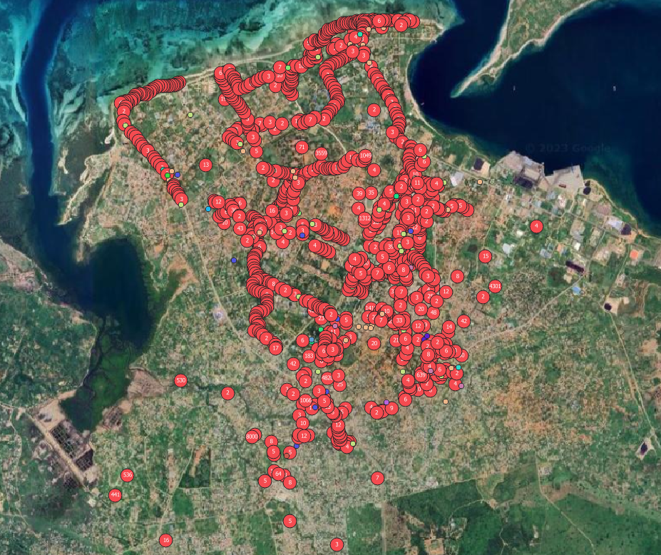
In the dataset, the litter is categorized by type, which allows collection of specific statistics and more specific use in the planning of waste management. In some areas the trash might be mostly food-wrappings while some areas might be littered with mainly plastic bottles. Dataset also shows the concentration points of litter, which are important areas of focus when planning waste management infrastructure from scratch. Most of the litter are plastic bottles, which can also be recycled to reuse. This dataset might then offer good possibilities for planning of recycling facilities such as bins and reverse vending machines. This kind of infrastructure is expensive, multileveled and hence needs careful planning.

Waste management is important in Africa from a human health perspective as well. In urban areas common litter items such as plastic bottles, tin cans, and styrofoam containers account for between 7 and 15 percent of the breeding habitats for the mosquitoes that carry Dengue and Malaria. Due to their limited range of movement, these mosquitoes spread these diseases more effectively in densely populated areas, areas that also produce large amounts of waste (Wilke et al. 2020).

The dataset is now available at Resilience Academy’s Climate Risk Database as Mtwara litter data 2022.

References

The annual fisheries statistics report (January – December) 2020 (2020). Fisheries Department, Ministry of Livestock and fisheries.

Wilke, A., Vasquez C., Carvajal, A., Medina, J., Chase C., Cardenas, G., Mutebi, J.-P., Petrie, W. & Beier, J. (2020). Proliferation of Aedes aegypti in urban environments mediated by the availability of key aquatic habitats. Scientifc Reports 10(1).

Share

Related articles

News30 Jun 2026

Building climate agency through geospatial and challenge-based learning – reflections of the Shape2Gether project

Authors: Niina Käyhkö, Sanna Mäki, Jukka Käyhkö   The Erasmus+ higher education cooperation project “Shape2Gether” (Shaping Innovations in Education for Sustainable Development: Contextualizing Geosciences, New Technologies, and Serious Games with Climate Change, 2024–2026) brought together seven university partners and one company from across Europe to transform education for sustainable development. The project aimed to integrate […]

Read more →
News, Training1 Apr 2026

Resilience Academy delivers four-day training on geospatial data collection, quality management, and sharing in the Climate Risk Database across two Tanzanian cities.

By Msilikale Msilanga, Amedeus Kimaro and Massoud Hamad In March 2026, the Resilience Academy conducted two rounds of a four-day training on Geospatial Data Collection, Data Quality Management and Sharing in the Climate Risk Database. The first round took place in Tanga from 9 to 12 March, and the second round followed in Mwanza from […]

Read more →
News9 Mar 2026

Shaping Together in Finland – Sharing the Shape2Gether Experiences in Turku

The Shape2Gether -project is about shaping innovations in education for sustainable development: contextualizing geosciences, new technologies, and serious games with climate change. If you wish to explore insights from the three summer schools that were organized during this project, you can find the Norway blog post here, the Malta blog post here, and the Germany […]

Read more →
News10 Jan 2026

85 students and alumni engaged in the 2025 Data Visualization Challenge to develop geovisualization solutions supporting urban water and climate resilience decision-making in Tanga and Mwanza.

By Msilikale Msilanga Young people develop the most robust skills when they engage in hands-on work on real-world problems. Resilience Academy organized another visualization challenge for 2025 as part of ProWA-SASA project, collaborating with partners like GIZ and ProWAS SASA Partners from Mwanza and Tanga cities. This initiative provided university students and recent graduates with […]

Read more →