[:en]Ramani Huria was excited to be invited by the University of Dar es Salaam (UDSM) to present on digital community mapping to GIS Masters students on 29th of February, 2016. The session was facilitated by Dr. Festus Ndumbaro, university lecturer on Cartography and GeoVisualization. Ramani Huria presented on ‘Web Maps’ and led a discussion with the students, allowing for knowledge transfer between graduated and current students from UDSM.

The Ramani Huria team began by giving an overview of community mapping they are facilitating on Dar es Salaam, with the focus on flood resilience. We explained how we conducted mapping, with students and community members, and some of the challenges and opportunities experienced thus far. Following this, we introduced OpenStreetMap (OSM) to the students, including some of the key principles of open source, that the map is free for all to use and reuse. The students were particularly interested in the differences between OpenStreetMap and Google Maps. The team explained that Google requires you to have a license in order use their map data, OSM on the other hand is free to use as long as you credit OSM.
Aerial imagery was also discussed with the students, Ramani Huria uses imagery we have captured ourselves with drones (mbtiles), Bing, and DigitalGlobe imagery. A student noted that the drone imagery captured by Ramani Huria is much clearer than other providers.

Following the session, students noted that they were very interested to learn more and requested the Ramani Huria return and present on additional topics, including JOSM and other tools to allow them to map and process data for their neighbourhoods. The facilitating lecturer, Dr. Ndumbaro, encouraged the students to spend some time to explore and experiment with OSM, learning the tools and mapping their own communities.
We found the students to be engaged and enthusiastic, asking many questions about all the topics raised through our presentations. At the end of the session they were left with a thorough and holistic knowledge of the work of Ramani Huria and OpenStreetMap.
The day was a great opportunity to share our mapping skills and experience with a new audience and continue our excellent relationship with the university, particularly the Department of Geography.[:sw]Ramani Huria walikuwa na furaha kualikwa na Chuo Kikuu cha Dar es Salaam(UDSM) kuwasilisha Jinsi ya kuhusisha jamii katika utengenezaji wa ramani kwa digitali kwa wanafunzi wa shahada ya Uzamili tarehe 29, Februari, 2016. Kipindi kiliendeshwa na Dr. Festus Ndumbaro Mhadhiri wa masomo ya kutengeneza Ramani na Taswira. Ramani Huria iliwasilishwa kwa ramani za mtandao na kuruhusu majadiliano na wanafunzi, kubadilishana maarifa kati ya wahitimu na wanafunzi kutoka chuo kikuu cha Dar es Salaam.
Msimamizi wa Utengenezaji wa Ramani Innocent Maholi akiwasilisha kazi za Ramani Huria .Picha kutoka Ramani Huria
Timu ya Ramani Huria ilianza kuelezea kwa ujumla jinsi walivyotekeleza zoezi la kushirikisha jamii kuandaa ramani katika mkoa wa Dar es Salaam ikiwa na lengo la kuzuia Mafuriko. Tulielezea namna tulivyokusanya taarifa kwa ushirikiano na wanafunzi pamoja na wanajamii, na baadhi ya changamoto na fursa tulizoziona. Tulifundisha OpenStreeMap (OSM) kwa wanafunzi, tukijumuisha kanuni za kutumia vyanzo wazi, kuwa Ramani ni huru kila mtu anaweza kutumia. Wanafunzi walionyesha nia ya kujua tofauti kati ya OpenStreetMap na Ramani za Google.Timu ilieleza kuwa Google inahitaji mtu kuwa na leseni kwa ajili ya matumizi ya Ramani, wakati OSM ni bure kutumia cha msingi kufungua akaunti.
Vile vile picha za Anga zilizongumziwa na wanafunzi . Ramani Huria wanatumia picha walizopiga wenyewe kwa kutumia drone(mbtiles), Bing na Digital Globe. Wanafunzi waligundua kuwa picha za anga zilizopigwa na drone inaonekana vizuri kuliko nyingine.
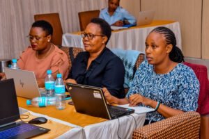
Wanafunzi wa shahada ya Uzamili wakipata nafasi ya kuuliza maswali wakati kipindi kinaendelea. Picha kutoka Ramani Huria
Kutokana na kipindi, wanafunzi walionekana wana shauku kubwa sana ya kujifunza zaidi kuhusu Ramani Huria hivyo waliomba wawezeshaji warudi na kuwafundisha mada nyingine zaidi, ikiwa ni pamoja na JOSM na zana nyingine ambazo zitawasaidia katika mchakato wa kukusanya taarifa na kuandaa ramani katika maeneo yao. Dr Ndumbaro, Ambaye ni mhadhiri aliwatia moyo wanafunzi kutumia muda wao kuchunga na kufanya majaribio ya OSM, kujifunza zana na kuandaa ramani katika jamii zao
Pia tuligundua kuwa wanafunzi wana shauku kubwa ya kujifunza ambapo waliuliza maswali mengi kutoka katika mada tulizoziwakilisha. Mwisho wa kipindi wanafunzi walikuwa na uelewa wa jinsi Ramani huria na Openstreetmap zinavyofanya Kazi
Hii ilikuwa ni siku kubwa kwetu ambapo tulipata fursa ya kuwashirikisha ujuzi na uzoefu wetu kwa wasikilizaji wapya pamoja na kuendeleza uhusiano wetu mzuri na Chuo kikuu cha Dar es salaam, hasa idara ya jiografia[:]