NewsNews
News12 April 2021

MiniMOOCs and other E-learning mateials as a resource to Challenge Campaigns

Currently the GeoICT4e experts are designing miniMOOCs related to knowledge and handling of digital geospatial data, sustainable development, climate change, innovations, and entrepreneurship, which are also the themes included in our pedagogical approach, Multicompetence Learning, which will be developed during the project. Massive Open Online Courses (MOOCs) are open to everyone, but work also as […]

Msilikale Msilanga

Resilience Academy

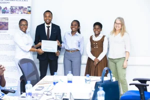
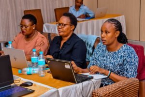
Photo: Resilience Academy

Currently the GeoICT4e experts are designing miniMOOCs related to knowledge and handling of digital geospatial data, sustainable development, climate change, innovations, and entrepreneurship, which are also the themes included in our pedagogical approach, Multicompetence Learning, which will be developed during the project.

Massive Open Online Courses (MOOCs) are open to everyone, but work also as a pathway to the so-called challenge campaigns, which have a significant role in the project.

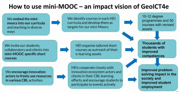
The team is now planning 40–50 so-called mini MOOCs. Mini MOOCs are short courses in which the amount of work varies from one day to a week. The idea is that MOOCs that can also be offered completely separate from the actual curriculum, for example as optional courses. The higher education institutions can later integrate the MOOCs into their own curriculums.

– The MOOCs help the students do well in the campaigns, as the campaigns might require competences that their own higher education institution has not been able to provide. The courses support learning before the campaign or during it, explains Romi Rancken, Senior Lecturer in Geospatial Education from Novia University of Applied Sciences.

Training of the Trainers-sessions launched the designing of MOOCs.

Mr. Rancken has given Training of Trainers- sessions related to MOOCs during Spring 2021. All 55 experts now have a common idea and pedagogical approach to planning.

– In the training session organised in February, we reminded ourselves about what competence-based education actually is, and what kind of requirements it imposes on planning the courses. We also discussed about the type of planning model needed to make the planning work easier. Now, the planning model is beginning to be ready to be tested, says Rancken.

Since the objectives of the project include establishing the sustainability issues of society and finding solutions to them by using e.g. geospatial information, the campaigns require mobility and information also from areas where there are no computers.

– In these scenarios, it is very useful to utilise mobile learning, which is an increasingly important form of e-learning, Rancken explains.

– We believe that as learning methods, e-learning, open mini learning contents, and challenge-based learning provide a better foundation for the young people’s ability to survive and help others in the modern world. If the HEI students succeed in capitalising the learning methods learned during the project, they will also have much higher chances of becoming life-long, independent learners capable of recognising and marketing their own competence, continues Romi Rancken.

Read more about MOOCs role in the project, and how coordinators from University of Dar es Salaam and Ardhi University in Tanzania see the role of the project in the original news in University of Turku web page, published 8th April 2021:
Multidisciplinary Expert Teams Develop Innovative E-learning Methods to Improve Digital Skills and Employment in Tanzania

Share

Related articles

News30 Jun 2026

Building climate agency through geospatial and challenge-based learning – reflections of the Shape2Gether project

Authors: Niina Käyhkö, Sanna Mäki, Jukka Käyhkö   The Erasmus+ higher education cooperation project “Shape2Gether” (Shaping Innovations in Education for Sustainable Development: Contextualizing Geosciences, New Technologies, and Serious Games with Climate Change, 2024–2026) brought together seven university partners and one company from across Europe to transform education for sustainable development. The project aimed to integrate […]

Read more →
News, Training1 Apr 2026

Resilience Academy delivers four-day training on geospatial data collection, quality management, and sharing in the Climate Risk Database across two Tanzanian cities.

By Msilikale Msilanga, Amedeus Kimaro and Massoud Hamad In March 2026, the Resilience Academy conducted two rounds of a four-day training on Geospatial Data Collection, Data Quality Management and Sharing in the Climate Risk Database. The first round took place in Tanga from 9 to 12 March, and the second round followed in Mwanza from […]

Read more →
News9 Mar 2026

Shaping Together in Finland – Sharing the Shape2Gether Experiences in Turku

The Shape2Gether -project is about shaping innovations in education for sustainable development: contextualizing geosciences, new technologies, and serious games with climate change. If you wish to explore insights from the three summer schools that were organized during this project, you can find the Norway blog post here, the Malta blog post here, and the Germany […]

Read more →
News10 Jan 2026

85 students and alumni engaged in the 2025 Data Visualization Challenge to develop geovisualization solutions supporting urban water and climate resilience decision-making in Tanga and Mwanza.

By Msilikale Msilanga Young people develop the most robust skills when they engage in hands-on work on real-world problems. Resilience Academy organized another visualization challenge for 2025 as part of ProWA-SASA project, collaborating with partners like GIZ and ProWAS SASA Partners from Mwanza and Tanga cities. This initiative provided university students and recent graduates with […]

Read more →